


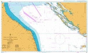
NOAA Chart 12273: Chesapeake Bay Sandy Point to Susquehanna River

 4.7 (43 items)
 Limited Time Sale
US$24.57 cheaper than the new price!!
Free cash-on-delivery fees for purchases over $99
Product details
| Management number | 210387515 | Release Date | 2026/04/02 | List Price | US$16.38 | Model Number | 210387515 | ||
|---|---|---|---|---|---|---|---|---|---|
| Category | |||||||||
The chart you are viewing is a NOAA standard nautical chart. Printed "on-demand," it contains all of the latest notice to mariner (NTM) updates as of the time of printing. The National Oceanic and Atmospheric Administration (NOAA) has partnered with OceanGrafix to provide commercial and recreational mariners with the most accurate nautical charts. These charts meet the definition of a nautical chart laid out in SOLAS Chapter V Regulation 2.2 and also meet the carriage requirements defined in SOLAS Chapter V Regulation 19.2.1.4
- OceanGrafix provides mariners with the most up-to-date, NOAA-approved nautical charts ever offered
- Printed on demand
- All Notice to Mariners corrections are applied to the chart when printed
- Meets U. S. and international carriage requirements for commercial vessels defined in SOLAS Chapter V Regulation 19.2.1.244
- U. S. Coast Guard approved
| UPC | 852675838156 |
|---|---|
| Map Type | Nautical |
| Brand Name | NOAA |
| Item Weight | 1.5 Pounds |
Bestseller ranking
Charts & Maps

Customers who viewed this product also viewed
Cases & Storage


Correction of product information
If you notice any omissions or errors in the product information on this page, please use the correction request form below.
Correction Request Form